About the Book
 

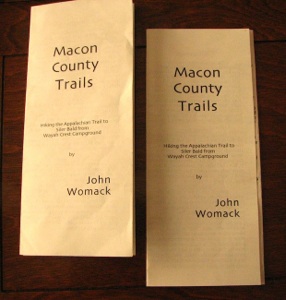
    This book was originally written and printed trail-by-trail as I hiked them and drove them.  I kept records, writing down events and items I felt were significant and then printed the trail guides crossways on an 8 X 10 inch page of paper, folded them three ways and sold to local merchants who would then resell them for about one dollar each.  I tried several titles including “Favorite Hikes of the Smokies”, and a few others, like “Easy Hikes in the Mountains”   and “Macon County Trails”, although a number of the trails, especially those on the Blue Ridge Parkway and some of the Appalachian Trail were well outside of Macon County.   Now finally, all those old trails are for the first time gathered together on this web page in their new home

“Trails in the Southern Mountains:  Hiking and Driving in the Blue Ridge”.


    When I began writing these trails, I had just moved to Franklin, NC, and began hiking in the Beautiful Mountains.  I thought then that I would hike ALL the trails in Macon County, NC, and write a “guide” for all of them.  Shortly after that, I slowly became aware that there are HUNDREDS of trails in Macon County, and that probably nobody has ever hiked them all!  So I started branching out.  “I will hike a lot of GOOD trails.”  And I did.  Some of them are recorded here.  I added “bits of wisdom”, on various brochures, some of it handed to me by more seasoned hikers.  So the only way you could all those comments and tricks was to buy all of my pamphlets!  Some of the hikes in this “book” still contain a few of those guidelines, but they all now reside in the part called “Trail Tips”.


This “book” is still in this web page format because, like a good cook book, there is no apparent end to it in sight.  True, I no longer go out on ten to twelve hour hikes all alone, and absolutely discourage ANY hiker from doing anything that dumb in the future.   But I have hiked other trails in other places and wished that somebody had written a trail guide  for the trail we were on.  Now, I realize that I can do that again, and hence this “book” now becomes an on-going tapestry of tales.  Stay tuned.

    After a few years in Franklin I established a photographic art gallery, helped start a photo club, published a monthly news letter and began leading monthly field trips into the mountains.  Those field trips lasted for almost ten years.

  While these trail guides do not go through a deep wilderness, you can still get into serious trouble easily.  Topographic mays are approximations, the times I have given are times I found usable to me. Blowdowns can obliterate trails, creeks constantly change course.  Mud is still slippery here, you just slide father. Typographical errors abound.  I once wrote a menu that called for 1/4 tsp of cayenne;  The “/” got lost.  If you stand there and put 14 tsp of cayenne into your chili, it is your fault!  Always do a reality check.

         Finally.  Check by the Forest Service areas. They will have other trail guides and other maps.   Get updated topographical maps.  Put these all together and you will make it easy and have a great time when you get out on the trail. PLUS, a large part of the enjoyment of hiking is the preparation!